Trail Walking La Baume-Cornillane - La Raye (Circuit PR n° 143) - Photo
© OpenStreetMap contributors
Length
Length
14.9 km
Max alt
Max alt
1004 m
Uphill gradient
Uphill gradient
818 m
Km-Effort
Km-Effort  
26 km
Min alt
Min alt
315 m
Downhill gradient
Downhill gradient
819 m
Boucle
Boucle
Yes
Creation date :
2019-05-05 16:45:00.975
Updated on :
2020-09-28 18:06:08.722

(0 Reviews)

Walking
Walking
4h30
Difficulty : Medium

Scan this QR Code to open this trail in the SityTrail application

FREE GPS app for hiking

Logo SityTrail SityTrail

IGN / Geographical institutes

Download SityTrail from the App Store Download SityTrail from Google Play

Logo SityTrail SityTrail World

The world is yours!

Download SityTrail from the App Store Download SityTrail from Google Play Download SityTrail on Huawei AppGallery

About

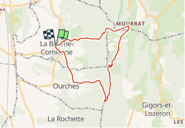
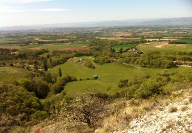
Trail Walking of 14.9 km to be discovered at Auvergne-Rhône-Alpes, Drôme, La Baume-Cornillane. This trail is proposed by Philindy26.

Description

Départ du village de la Baume-Cornillane (327 m) au parking de la Mairie ...
Géolocalisation (Google Maps) : https://goo.gl/maps/s87KCqp1Prz8rx8RA .
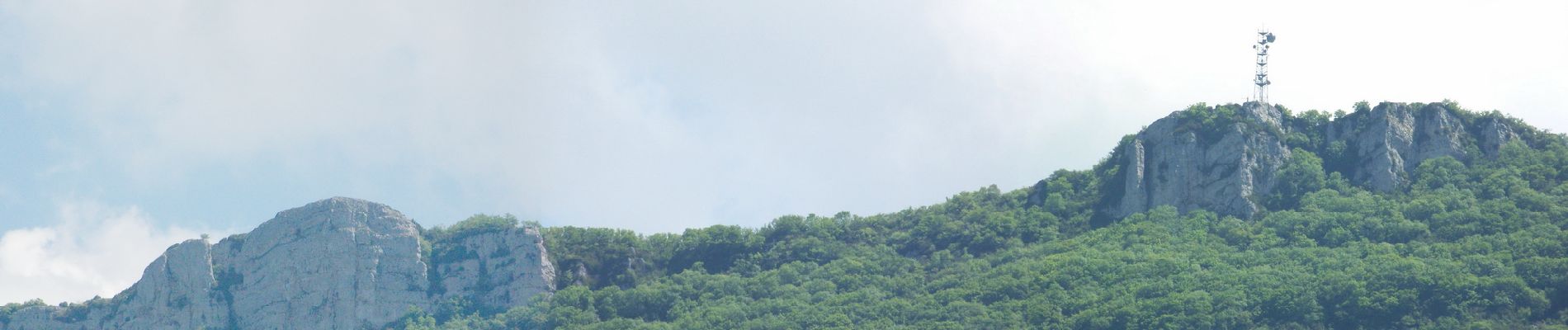
Montée par les rochers de la Pangée, Serre-Perrier (550 m), le Pas de la Croix (876 m), le Pas du Buis, le hameau de Mourras, le sommet de la Raye (1015 m).
Suivre les crêtes et descendre par le col d’Ourches (843 m), les Grands Échevins (380 m).
Et retour au village de la Baume-Cornillane…

Elevation profile

Photos

Positioning

Country:
France
Region :
Auvergne-Rhône-Alpes
Department/Province :
Drôme
Municipality :
La Baume-Cornillane
Location:
Unknown
Start:(UTM)
661248 ; 4965349 (31T) N.

Trails nearby

Trail Walking Barcelonne - Barcelonne -  autour de la Tour - Description et photos - Photo
Walking
bob2023

Walking

Easy
(3)
Barcelonne, Auvergne-Rhône-Alpes, Drôme, France
4.3 km | 6.6 km-effort
1h 29min
Yes
Trail Walking Barcelonne - Barcelonne-Combivin-Chapelle St Marguerite  - Photo
Walking
amorin

Walking

Easy
(1)
Barcelonne, Auvergne-Rhône-Alpes, Drôme, France
8.7 km | 13.5 km-effort
2h 20min
Yes
Trail Walking La Baume-Cornillane - Pas du Pont - Pas de la Croix - Pas du Buis - Photo
Walking
patbt

Walking

Medium
(2)
La Baume-Cornillane, Auvergne-Rhône-Alpes, Drôme, France
10.3 km | 18 km-effort
2h 52min
Yes
Trail Walking La Baume-Cornillane - pas du pont - Photo
Walking
jojomarette

Walking

Easy
(1)
La Baume-Cornillane, Auvergne-Rhône-Alpes, Drôme, France
6.9 km | 9.8 km-effort
3h 22min
Yes
Trail Walking Gigors-et-Lozeron - 26 st supporte gigors - Photo
Walking
himba26100

Walking

Medium
Gigors-et-Lozeron, Auvergne-Rhône-Alpes, Drôme, France
16 km | 24 km-effort
5h 8min
Yes
Trail Walking Montvendre - Barcelonne- Les Pialoux - Photo
Walking
amorin

Walking

Easy
Montvendre, Auvergne-Rhône-Alpes, Drôme, France
8.1 km | 12.1 km-effort
1h 57min
Yes
Trail Walking Montvendre - pas du buis - Photo
Walking
guyzinz

Walking

Very difficult
Montvendre, Auvergne-Rhône-Alpes, Drôme, France
38 km | 48 km-effort
6h 32min
No
Trail Walking La Baume-Cornillane - La Baume-Cornillane  - Photo
Walking
meillon

Walking

Medium
La Baume-Cornillane, Auvergne-Rhône-Alpes, Drôme, France
10.7 km | 15.8 km-effort
3h 56min
Yes
Trail Walking Gigors-et-Lozeron - la rivière.gigors.lozeron. - Photo
Walking
Joel26400

Walking

Easy
Gigors-et-Lozeron, Auvergne-Rhône-Alpes, Drôme, France
18.1 km | 29 km-effort
7h 2min
Yes


Close
My subscriptions